The week begins with the National Hurricane Center (NHC), tracking and following three areas throughout the Atlantic Basin. A Tropical Storm in the Gulf, a system-to-be East of Florida, and a concerning wave in the Eastern Atlantic.

We begin with Nicholas
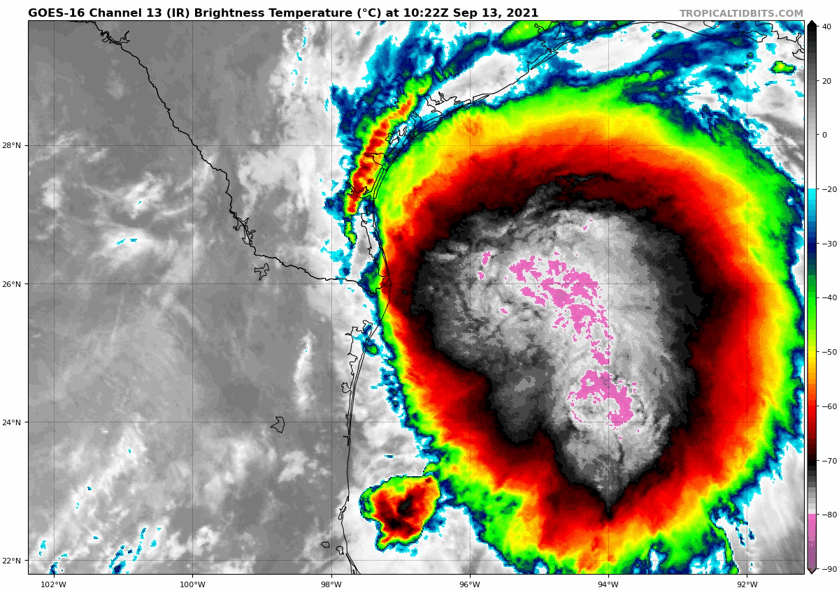 |
| Courtesy Tropical Tidbits |
A curious thing happened with Tropical Storm Nicholas overnight, the center (used to track its place and movement) reformed farther north than earlier on Sunday.
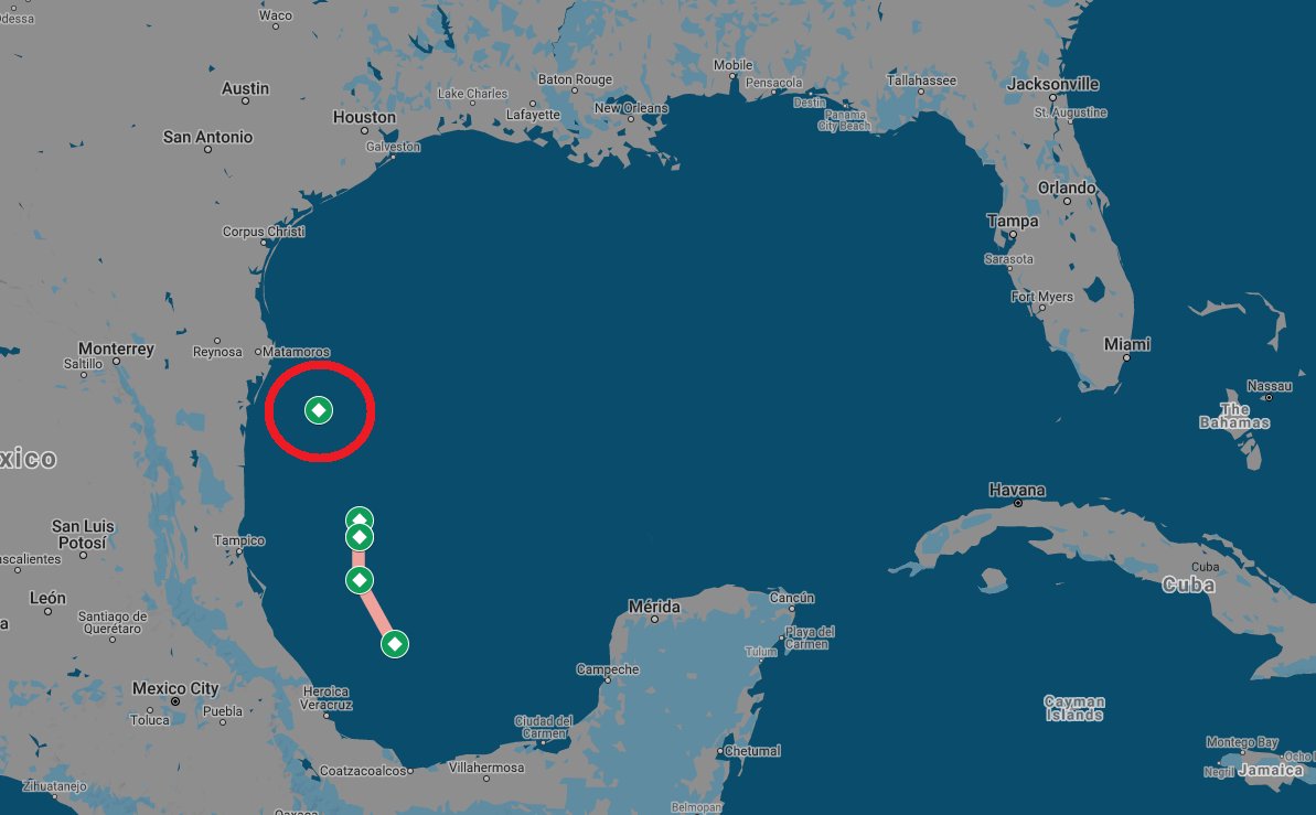 |
| Courtesy Josh Morgerman |
Reviewing its recent track, you can see where the center was, and where it can be found presently. It made a huge leap. This means less prep time for folks along the coast of Texas.
Landfall Site?

The system may be too close to shore fur further intensification, but rain will be a concern.
Impact Data from NHC
Heavy rainfall will impact portions of the Texas and Louisiana
coasts through the middle of the week. Significant rainfall amounts
are possible, potentially resulting in areas of considerable flash
and urban flooding, especially in highly urbanized metropolitan
areas. Isolated minor to moderate river flooding is also expected.

2. There is the danger of life-threatening storm surge inundation
along the coast of Texas from Port Aransas to San Luis Pass.
Residents in these areas should follow any advice given by
local officials.

3. Nicholas is forecast to approach the middle Texas coast as a
strong tropical storm today, and could be near hurricane
intensity at landfall.  Tropical storm conditions are expected
along portions of the middle Texas coast beginning by this
afternoon, with hurricane conditions possible from Port Aransas to
Freeport this afternoon and tonight.

4. Tropical storm conditions are expected along portions of the
northeastern coast of Mexico and the coast of south Texas beginning
during the next few hours.Area East of Florida

This is a great NOAA satellite image of night turning into day across the Western Atlantic. The area of clouds to the East of Florida now has a 50% chance for organization somewhere in the area highlighted over a period of 5 days (See map at top of blog). If it develops it should move on a north/northwesterly track.
New Wave by West Africa

This is Invest95L. You can barely make out the West Coast of Africa. That mass of clouds and rain has just moved offshore. It could develop anywhere in red shaded area. (See above Map)
Where may it go?

Early model runs show a W/NW track. Many things are in play here. A slow moving system would make it stronger while a faster one should keep it weaker. Models at the moment are still getting their footings with this new disturbance. Anything developing in the sector should be watched and monitored. It has an 80% chance for organization and may develop into a depression/storm sometime later this week.
We'll be watching


No comments:
Post a Comment