The National Hurricane Center (NHC) raises chances for a wave to develop in the Atlantic Ocean over the next five days. Late Thursday night it was deemed Invest94L.

The Latest from NHC

Data from Friday morning, suggests the Tropical Wave has a 60% chance (up from 20% Thursday morning), of becoming a depression somewhere in the orange area during the next 5 days. Waters are running warm and that could supply the energy it needs to grow.
Models
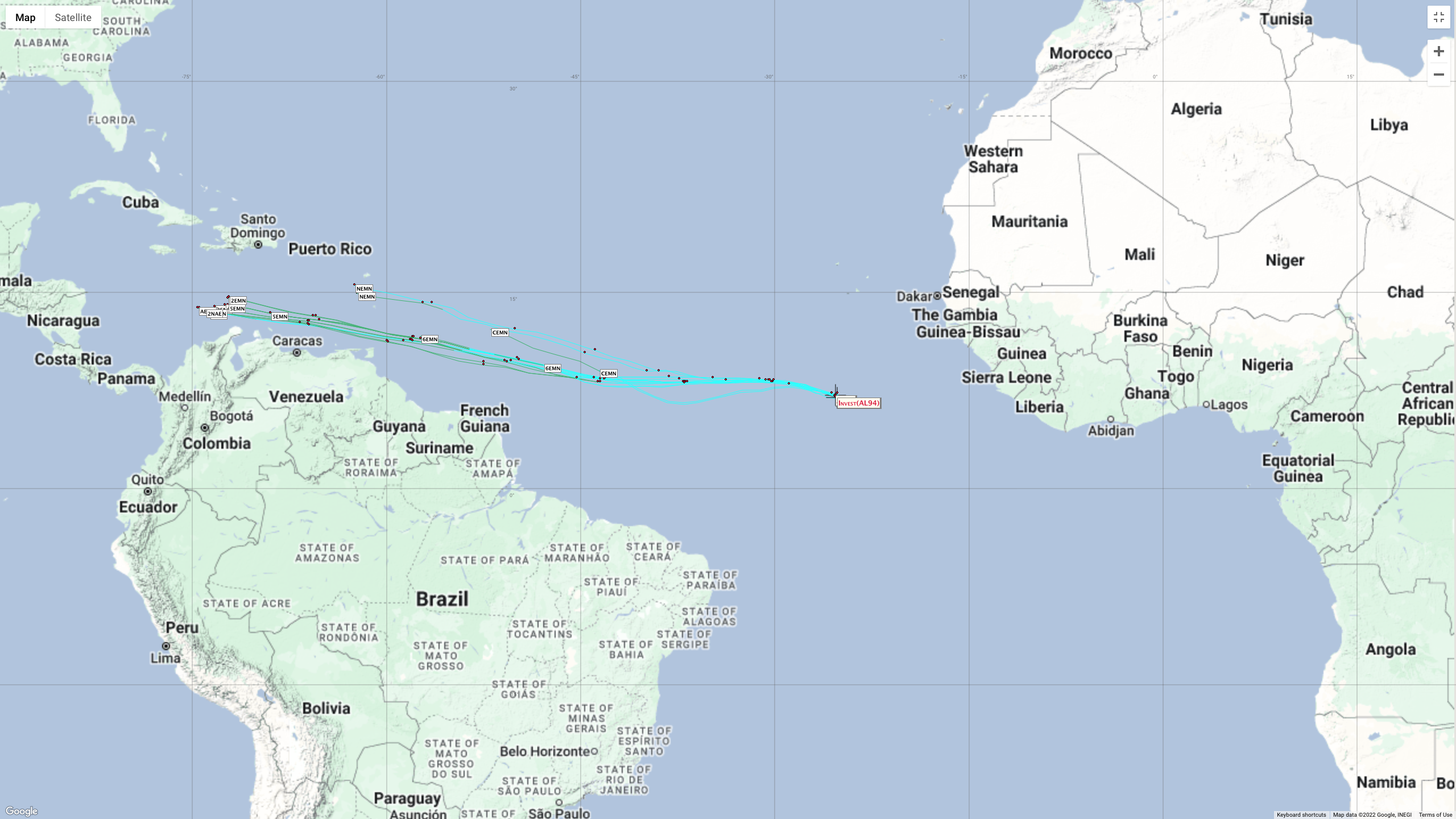

Another look at several more models of Invest94L. A reminder that since nothing has developed, the models have no starting point, so at the moment, they are just providing a general view of the possible track.
Each line represents where the center of the storm may be at any given time in the graph. Some models are statistical while others show a track if nothing were to change.
For example take the black triangled line above. This is the Extrapolation model. It says, if the system has been moving NW over the last 12 hours, it will continue to move NW. As you know, there are so many variables in forecasting that a track could change within hours. Deviations in a forecast can come at any time.
Why the Bullish Forecast?
Three major factors are in play.
- The wave has plenty of moisture allowing it to form more thunderstorms.
- It'll be moving over warm waters.
- Little to no roadblocks in the way of Shear, or strong upper winds that can keep it from organizing

This lack of shear will remain in place by the time it reaches the Windward Islands. Folks there should keep an eye on it. Even if it doesn't organize it should still drop plenty of rain. If this system were to be named it would be called Bonnie.
The rest of the Caribbean, the Bahamas and South Florida, just keep monitoring it. This is a good reminder to check your supplies. We'll be watching.


THANK YOU PHIL
ReplyDeleteMy pleasure
ReplyDelete