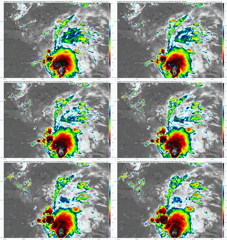
Tropical Depression Fred is moving across north Cuba on track towards the Florida Keys. Should be near the island chain Saturday midday.
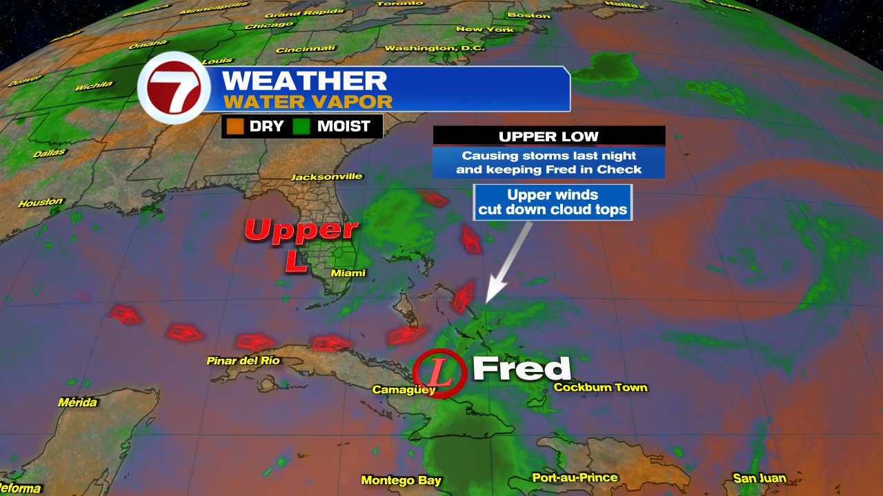
The satellite imagery shows a poorly organized depression. The center spin is almost across Central Cuba, while all the clouds and rain are on the Eastern end of the Island. One of the reasons why Fred is in bad shape is the rain over South Florida.
An upper low is parked over Florida dragging moisture our way and causing the strong storms. At the same time, the counter clockwise winds from the low, are shearing the cloud tops from Fred and disrupting its spin. This disruption however will relax later today allowing the system to gain some intensity. It could reach tropical storm status by Friday Afternoon.
Where is it going?
For the So Florida audience, Fred will track towards the Florida Keys. Possible arrival should be closer to midday Saturday. It will then move towards Florida's Panhandle.
A TROPICAL STORM WARNING has been issued for the island chain. This means wind speeds of 40 mph or better can be expected in the next 24 hours.
Fred is not expected to be a wind event, but it is forecast to drop plenty of rain.
A FLOOD WATCH- will go into place at 6 pm Friday for the Keys and at 8 pm for Miami Dade & Broward Counties.
Possible Impacts Info From NHC
Over Cuba and the eastern Bahamas...1 to 3 inches with isolated
maximum totals of 5 inches.

Across the western Bahamas...3 to 5 inches, with isolated maximum
totals of 8 inches.

From today into Monday, 3 to 7 inches of rain is anticipated across
the Keys, southern and central Florida north towards the Big Bend,
with isolated maximum totals of 10 inches. Heavy rainfall could lead
to areal, urban, and small stream flooding, and potentially worsen
ongoing minor to isolated moderate river flooding over northern
Florida.
LOCAL IMPACTS
- Gusty winds to 40 + mph will be more prevalent throughout the Keys by Saturday midday.
- For Miami Dade & Broward Counties, we MAY get some of that in the form of strong rain bands coming in. These rain bands will be on & off. There will be stretches of quiet weather and then a line moves through with torrential rainfall.
- This pattern will stay thru Saturday night.
- 4"-7" of rain is forecast
- The ground will not absorb any more rain and additional downpours will lead to flooding.
- STAY ALERT, if driving, you may not tell where the road ends and a canal begins.
As with any tropical system moving through or near our area, impacts can be felt far away from the cone. Aside from rainfall, isolated tornadoes will also be possible.
I'll be watching.
asdasdsa


No comments:
Post a Comment