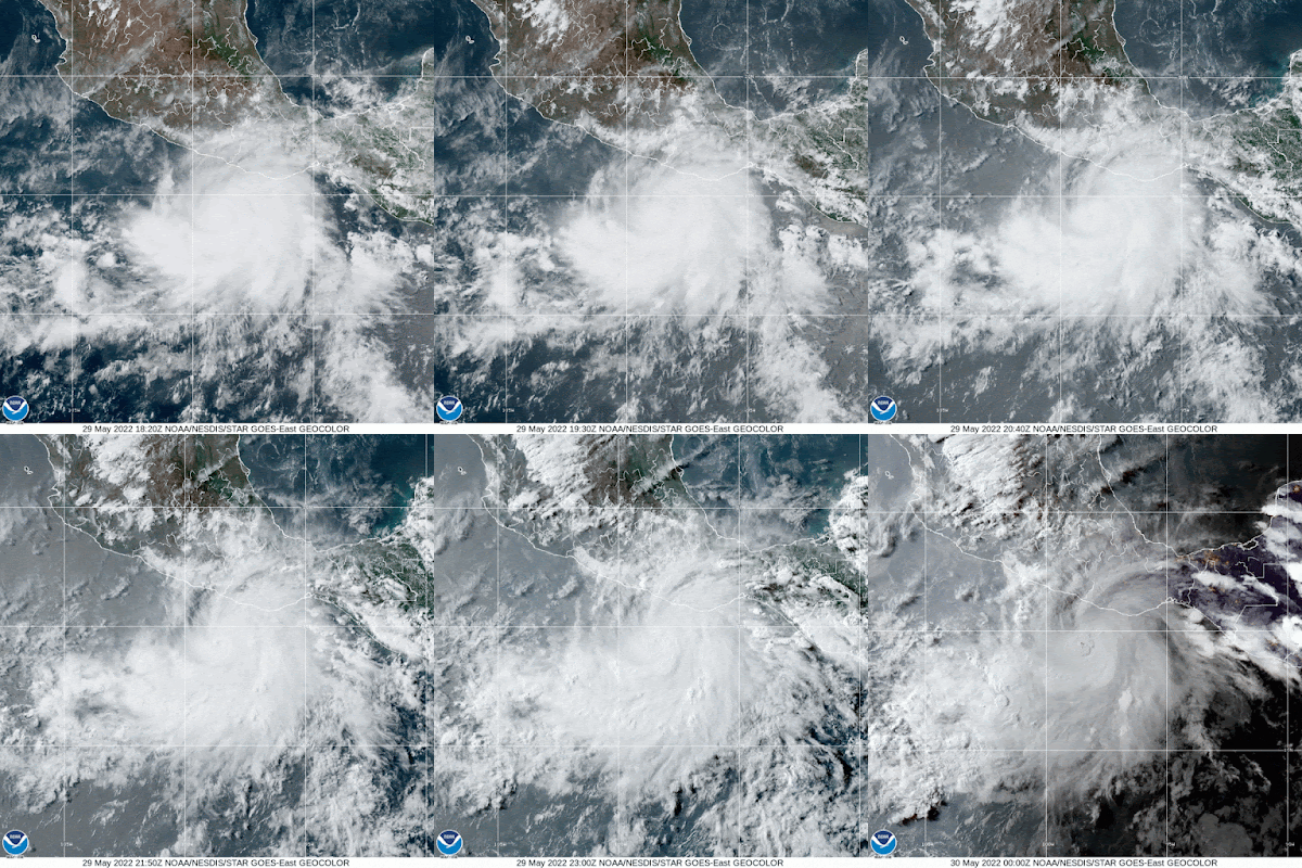
A powerful hurricane is battering Southern Mexico at this hour. It will continue towards the coast through Monday afternoon. That's when it's expected to make landfall, with a strong storm surge, heavy rain and intense winds. It may be a major hurricane, category three, by then.
The satellite imagery shows Hurricane "Agatha". A well organized system moving onshore. It has been intensifying rather quickly and is forecast to get even stronger overnight. The hurricane is moving very slowly northward and will continue to feed off the warm waters.
Advisory & Cone
The forecast cone from the National Hurricane Center shows a possible landfall Monday afternoon, then inland by Tuesday.
Why the Northeast Track?
This surface map from the Mexican Meteorological Office shows a blue arrow pointing East across Northern Mexico and into Louisiana. That is part of the jet stream, or a strong river of wind in the atmosphere.
Typically, systems that develop in the Pacific Ocean tend to move West/northwest. In this particular case, Agatha is being pushed northeastward due to the subtropical branch of the jet stream.
Looking Ahead
The National Hurricane Center (NHC), suggests that the Mexican High terrain should dissipate Agatha in roughly 36 hours. It should still be over land. But, if the remnants survive into the Gulf of Mexico, the warm waters there could brew something back up.


Thank you
ReplyDelete