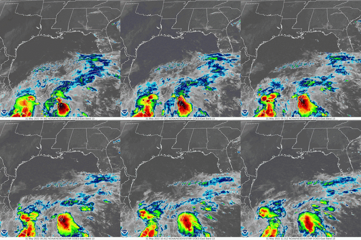
As of Tuesday morning, the National Hurricane Center (NHC), says Agatha has weakened into a depression over Mexico. Now it's our turn to keep an eye on whatever is left of the system.
The mass of clouds moving towards the Yucatan Peninsula is Agatha. Not well organized with weaker winds, but still plenty of rain. You will notice a streak of clouds moving west to east just to Agatha's north... this is a strong river of wind known as the Subtropical Jet Stream. It will be the main driver in pushing Agatha's remnants our way. It could also prevent it from restrengthening. This is something we will track carefully.
The morning advisory & cone suggests that by this afternoon or early evening, the system will have fallen apart.
What Next?
NHC suggests that Agatha's leftovers may reorganize in the area highlighted in orange. They give this possibility a 60% chance. Even if it doesn't develop, a broad area of low pressure is forecast to form and spread all of Agatha's moisture towards Cuba, So. FL and the NW Bahamas.
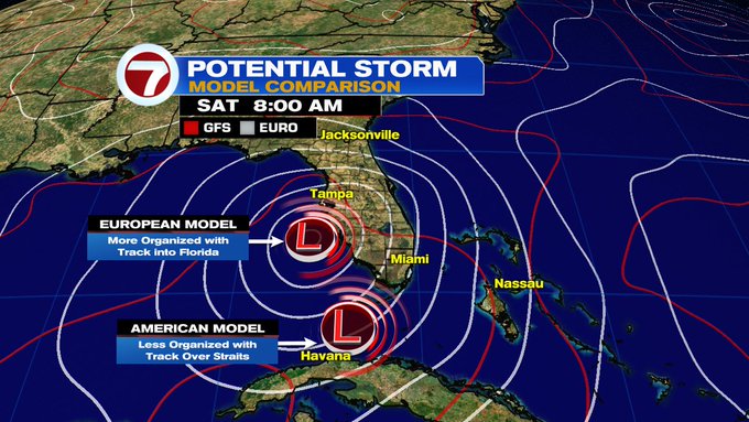
Model Comparison
Both the EURO & GFS, place a low near Florida by Saturday. The EURO puts it by SW Florida and the GFS in the Straits. While the EURO puts it away from South Florida it would be the wettest scenario for us. The GFS could cause strong downpours by the Keys and some on & off rain for the Mainland. The NW Bahamas will see some heavy rain either way.
Weather or Not?


Thank you Phil.. fingers crossed.
ReplyDeleteThank you
Delete