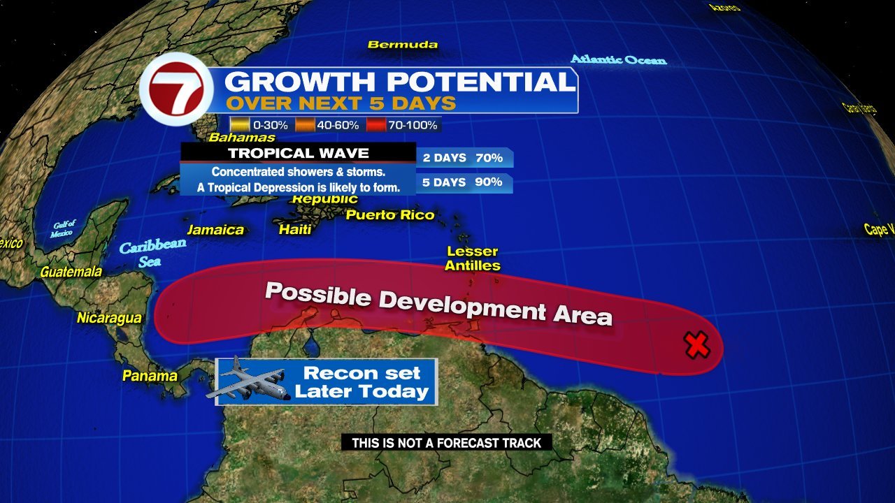
UPDATED: The new week starts with the National Hurricane Center (NHC) monitoring two areas for development in the Central Tropical Atlantic and a third in the Gulf of Mexico.
We start with the first Atlantic Wave
This satellite view shows imagery over the Atlantic. The area of clouds we are focusing on is roughly 900 miles E/SE of the Windward Islands. A NOAA high altitude recon mission is set for today with hurricane hunters on standby for Tuesday.
The wave maintained its form over the weekend without getting stronger, but now conditions appear more favorable for further development. It's moving West 15 - 20 mph.
NHC is giving this wave a 90% chance that it could become a depression/storm anywhere inside the red highlight over a period of 5 days. If it reaches tropical storm status it will be named "Bonnie". Even without organization it could drop plenty of rain across the Windward Islands, Trinidad & Tobago, as well as Northern Venezuela. Advisories could be issued for them as early as today.
Second area of concern in Atlantic
This is another wave just behind the first. It is moving WNW at 15 mph. This one could be more of a headache as it appears to be tracking farther north than the previous.
NHC suggests it has a 20% chance for organization inside the yellow area over a 5 day period. The Lesser Antilles could see pockets of heavy rain in the days ahead.
Activity in the Gulf
The area of clouds sitting mostly over Louisiana, Mississippi, & Alabama is a disturbance that has a low chance for intensification.
NHC says it will drift west and possibly organize by the Texas Coastline. They give this possibility a 20% chance over 5 days. Even if it doesn't come together it will be capable of heavy rain.
We'll be watching


No comments:
Post a Comment