Tuesday morning had the National Hurricane Center (NHC), keeping tabs on two tropical waves in the Atlantic.

Find the Lesser Antilles in the center of this picture. To the right you will see some clouds, these are the two waves being monitored by NHC.
Area Number One (Invest 95L)

This wave is about 800 miles East of the Lesser Antilles moving in their direction at around 15 to 20 mph. It has a 40% chance that it could become a depression/storm somewhere in the area highlighted orange over a period of 5 days. It could be close to the Islands by Wednesday.
Models

Nothing has developed yet. IF it were to organize, this is what the early model runs suggest. Keep in mind since nothing has formed, the models are providing only an educated guess. It gives us an idea of a possible track.
Parts of the Lesser Antilles could see rainfall by midweek from the wave.

Both waves are being nagged by dry air in the form of Saharan Dust and that could keep them in check. The dust shown here in bright oranges and reds is moving west along with the waves.
Area Number 2 (Invest 97L)
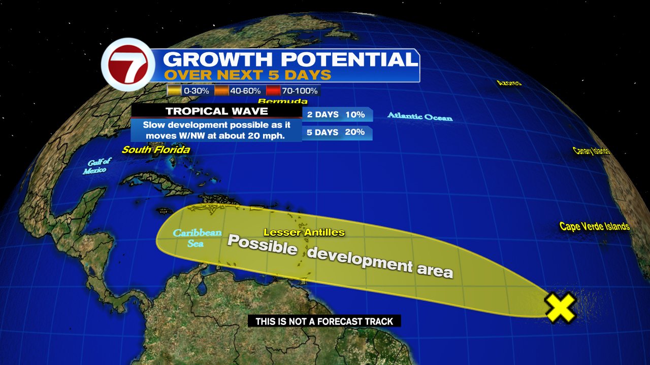
Has a 20% chance for development anywhere in the yellow area over a 5 day span.
Models

Once again, these are just preliminary projections. Models need to have a well organized system to provide accurate forecasts. They show a possible track towards the Windward Islands and then into the Central Caribbean. Still, too many factors in flux to get a good handle on its future.
Tropical Storm Danny

Spun up quickly from Tropical Depression 4 on Monday afternoon. It made landfall near Hilton Head, S.C. with 40 mph winds. It fell apart very early Tuesday morning.
I will keep you updated on any changes regarding the tropics, on-air, on-line, and on social media.
We'll be watching


It's too early 🤦♀️ Thank you for the update!
ReplyDeleteThank you
ReplyDelete