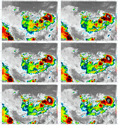
Fourteen days into hurricane season and the National Hurricane Center (NHC) is following three areas. New Tropical Depression two, and two other areas for possible development. Bill would be the next system in line if the depression intensifies further. We already had Ana even before the season started.

This is Invest 92L. Most models keep it in the Bay of Campeche. The two models showing a northward jog are the XTROP & CLP5. The XTROP says, if it has been slightly moving North over the last 12 hrs, it will continue to move in that direction the next 12 hrs. The CLP5 is mostly historical. A look at average tracks other systems took that developed in that area.
A strong Tropical Wave hugging the West Coast of Africa is being given a low chance for growth. It is expected to run into a big road block in a few days in the form of a huge plume of Saharan Dust. NHC is giving it a 20% chance for organization over 5 days.
Saharan Dust on the Move
Great shot from Space showing the dust plume which has already moved into the Eastern Caribbean Sea. Model forecasts suggest that Cuba, NW Bahamas, & South Florida could see some of that dust by the end of the week or weekend. The dust is an irritant and a bigger health concern for folks with respiratory issues.
We'll be watching
By the way, last year at this time we had the biggest Saharan Dust Cloud on record. It was nick-named Godzilla. Our 7Weather podcast "Weather or Not?" Has a look at the reasons why it happened. Check it out on Spotify, Apple, or Google.


No comments:
Post a Comment