The First Major Hurricane of 2022
Major Hurricane Category 3 Fiona, is leaving flooding and destruction in its wake. Presently battering the Turks & Caicos and aiming for Bermuda possibly even stronger upon arrival.
Satellite Loop

Over the early morning hours of Tuesday, USAF hurricane hunters detected a much lower pressure reading with stronger winds. It is now the first Major Storm of the season.
If there is one thing that could keep this monster from gaining more strength is the impact Shear, or strong upper level winds, is having on the western side of Fiona. It is preventing outflow from the storm.
Imagine an engine with an exhaust pipe. A hurricane is a tropical engine and its exhaust pipe is wind rushing to the very top of the hurricane and exiting. Well the shear is preventing that from happening, keeping Fiona from firing on all cylinders, and yet here we are with a cat three on our hands.
What next for Fiona?

It will track NW for a day or so and then make a northeasterly turn and trek towards Bermuda.
In the meantime:
- Turks & Caicos (Located at the extreme Southeast stretch of the Bahamas) will get hit hard by this major system throughout the day.
- Strong gusty downpours will remain on and off across Eastern Dominican Republic
- More pockets of heavy rain will hamper clean up efforts in Puerto Rico. Additional street flooding is possible
- Bermuda should be prepping just in case Fiona does not weaken
For the latest on storm forecasting, clean up, donations, and storm updates please follow us on-air and on-line for the latest.
Tropical Wave to Watch
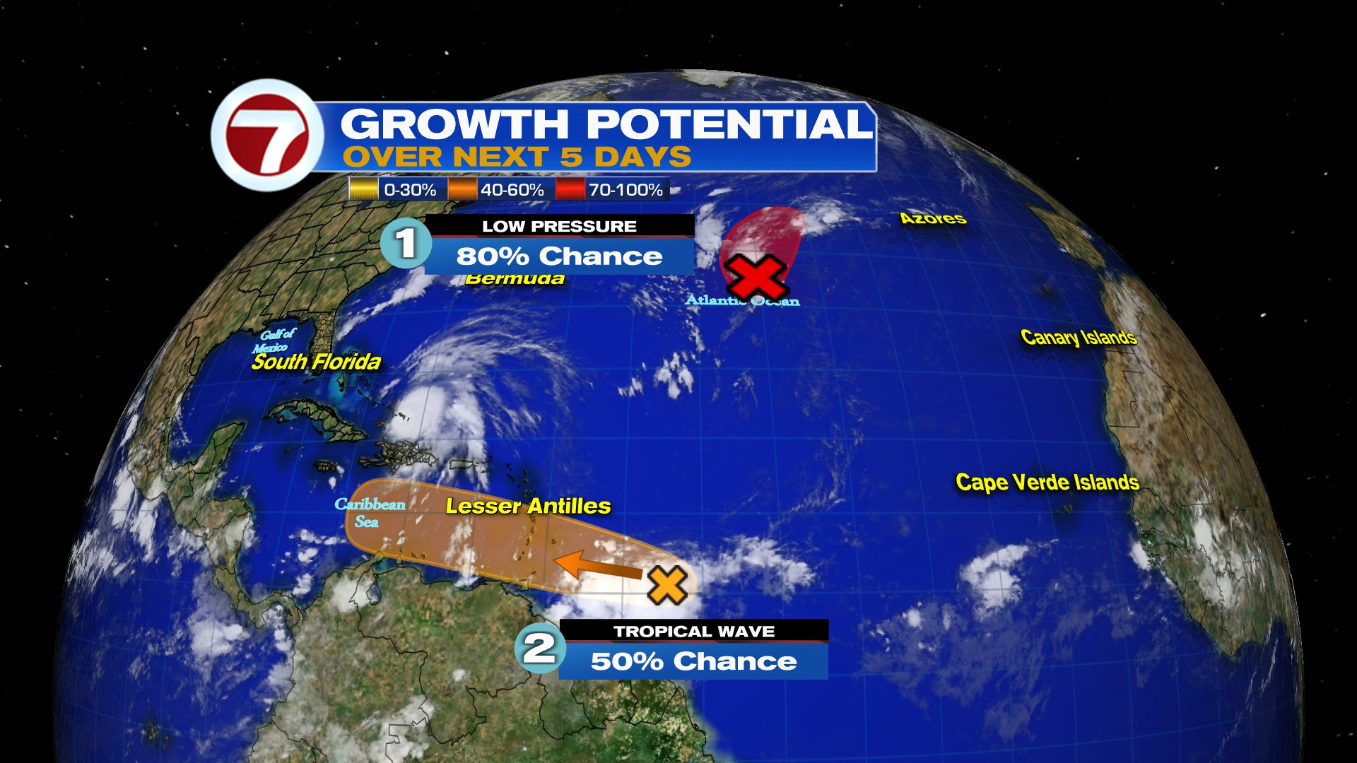
The National Hurricane Center (NHC) is actually monitoring two ares for development. The one in red was upgraded to Depression 8, it should just be a worry for the shipping lanes. Meanwhile the one in orange will be a concern throughout the Caribbean.

This robust wave is sitting a couple of hundred miles East of the Windward Islands. It has plenty of thunderstorm activity and may develop into a depression or storm in the area highlighted.
This is now Invest98L
Located: 10.3N, 53.0W. The pressure is holding at 1011 mb with winds around 30 mph.

Extremely early models suggest a track into the Caribbean or Gulf of Mexico. These are just guesstimates but they give us a general idea of the area the system may be down the road. They will change plenty in the days ahead. For my Caribbean friends, please monitor the wave carefully so you have time to prepare. For South Florida. Keep your eyes on it. This is another example that Hurricane season is still here and getting very active.
We'll keep watching


No comments:
Post a Comment